Sophisticated Hardware as the Foundation of Excellence
At Fair Lifts Unmanned Services, we recognize that true field expertise is only as effective as the instruments behind it. The Sylvester region, celebrated as a global hub for peanut and cotton production, requires technology that can withstand the heat and humidity of the Coastal Plain while delivering surgical precision. We don't simply "fly drones"; we manage an evolving, mission-critical technology ecosystem. Our fleet undergoes annual refreshments to ensure Worth County enterprises are always operating at the cutting edge. From the dense pine stands of rural Georgia to the expansive row-crop acreage that fuels our local economy, our systems are built for the specific environmental stresses of our region.
Collaborating with Fair Lifts allows local businesses to eliminate capital risk and technological stagnation. The drone industry moves at a breakneck pace, often rendering hardware obsolete in less than two years. By leveraging our specialized services, South Georgia's industrial and agricultural leaders gain the power of a multi-million dollar fleet without the burden of upfront costs, complex maintenance, or specialized pilot training. Whether you are managing a 5,000-acre multispectral vegetation study or conducting a high-stakes infrastructure audit, we guarantee the use of the most secure and efficient aerial platforms available on the global market.
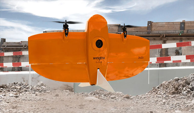
WingtraOne Gen II: The Standard for Large-Scale Mapping
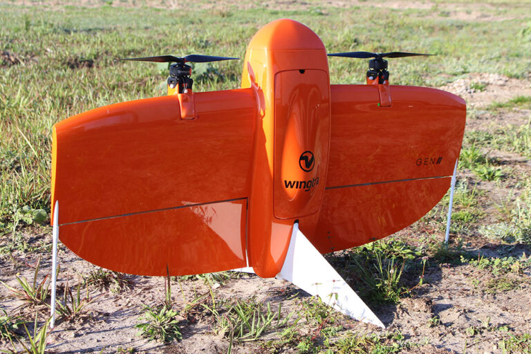
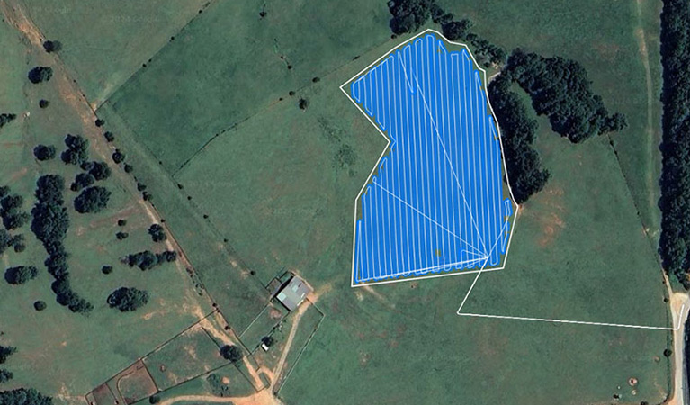
When the mission calls for wide-area surveying and high-resolution mapping, the WingtraOne Gen II is our primary asset. In a county as expansive as Worth, efficiency is the difference between a project’s success and a logistical bottleneck. The WingtraOne is a sophisticated fixed-wing drone featuring Vertical Take-Off and Landing (VTOL) technology. This hybrid design allows us to launch from confined spaces—like narrow logging trails or field edges—eliminating the need for a runway while maintaining the long-range endurance of a plane. A single Wingtra deployment can cover over 700 acres, outperforming standard multi-rotor drones tenfold.
Speed, however, never compromises data integrity. The WingtraOne Gen II is outfitted with a high-performance Post-Processed Kinematic (PPK) GNSS engine. By syncing this with our localized Emlid base stations, we provide centimeter-level absolute accuracy. For Sylvester-area engineers and developers, this means receiving survey-grade digital twins and topographic data faster and more affordably than traditional ground-based methods.
XAG P150: Revolutionary Precision Application
For the vital tasks of crop protection and environmental management, we utilize the XAG P150—the industry's leading heavy-lift application platform. Given the humid climate of the South Georgia Coastal Plain, the window for effective fungicide and insecticide application is incredibly tight. The P150 is designed for the grit and high-intensity duty cycles of the "Peanut Capital." It carries a robust 70L payload and utilizes high-capacity centrifugal atomization. Unlike standard nozzles that are prone to clogging or inconsistent droplet sizes, our atomization system ensures a uniform, controlled spray that maximizes chemical efficacy and minimizes off-target drift.
The true technical advantage of the P150 lies in its aerodynamic design. The powerful downwash from its rotors creates a high-pressure vortex that actively "flips" the crop canopy as the drone passes overhead. This ensures that the spray doesn't just sit on the top of the leaves but is driven deep into the base of the plant. For Worth County peanut and cotton growers, this 360-degree coverage is a game-changer for combating white mold and hidden pests. We transform days of slow, soil-compacting ground-rig work into hours of precision aerial application.
| UAS Feature | Benefit to Sylvester Farmers |
|---|---|
| Variable Rate Application | Apply chemicals only where needed based on high-resolution map data, reducing input costs. |
| Zero Soil Compaction | Effective spraying immediately after heavy rains when ground rigs would cause permanent soil damage or get stuck. |
| Multispectral Imaging | Identifying "hidden" crop stress and nutrient deficiencies before they are visible to the naked eye. |
| Swarm Technology | Multiple drones working a single field in coordination to cover large regional acreage with maximum efficiency. |
Blue UAS: Uncompromising Data Security
In today’s climate of heightened cybersecurity awareness, the origin and security of your aerial technology are paramount—especially for government contracts and critical utility infrastructure. Fair Lifts is dedicated to safeguarding regional data. Our survey operations prioritize Blue UAS Certified platforms. This designation, strictly vetted by the U.S. Department of Defense, confirms that our equipment adheres to the highest tiers of supply chain integrity, data encryption, and cybersecurity. When we survey a municipal asset or a power grid in Sylvester, you can rest assured your geospatial intelligence is protected from the moment of capture to the final delivery. We eliminate the vulnerabilities inherent in unvetted, consumer-grade platforms.
Actionable Intelligence: Turning Data into Decisions
Our job isn't finished when the rotors stop spinning. We believe the true value of aerial intelligence lies in the processing. We employ the PIX4D software ecosystem, utilizing PIX4Dmatic for expansive industrial photogrammetry and PIX4Dfields for high-speed, in-season agricultural diagnostics. These advanced tools allow our data specialists to convert massive volumes of raw imagery into high-fidelity orthomosaics, 3D point clouds, and multispectral plant health maps. We deliver final products in the CAD, GIS, and farm management formats your professional staff already utilizes, ensuring a seamless flow of intelligence into your daily operations.
Payload Technology
MAP61 / RGB61
Full-frame Sony sensors providing ultra-high resolution for forensic-level mapping and 3D reconstruction.
Riegl miniVUX LiDAR
High-frequency laser pulses that penetrate the thick Georgia timber canopy to reveal the true ground terrain with millimeter precision.
MicaSense RedEdge-P
Advanced multispectral imaging with five specialized bands to detect crop stress and nutrient deficiencies before they are visible to the naked eye.
Local Reliability
Our Sylvester-based operations maintain a comprehensive parts inventory and a fleet of redundant aircraft. If a system requires maintenance, a backup is immediately available to keep your project on schedule.
Request Technical Brief