Advancing Professional UAV Operations in the Peanut Capital
Welcome to the Sylvester operational hub for Fair Lifts Unmanned Aerial Services. Within this cornerstone of the Georgia Coastal Plain, we believe that combining cutting-edge technology with deep-rooted local knowledge is the only path forward for a modern, resilient economy. Sylvester is far more than a crossroads; it is the vital engine of Worth County’s farming and industrial identity. From the sprawling peanut stands along Highway 82 to the heavy timber tracts and emerging logistics corridors, Fair Lifts offers the technical infrastructure that empowers regional enterprises to optimize, scale, and lead.
Our philosophy centers on one core truth: data is useless unless it drives decisions. For too long, the drone industry has been perceived as a novelty—a source of pretty pictures that lack real-world utility. Fair Lifts is rewriting that script. We are leading the transition of unmanned systems from hobbyist tools to indispensable industrial infrastructure. With a background grounded in rigorous aviation safety and sophisticated project management, every Sylvester mission is handled with surgical exactness and a nuanced understanding of the specific environmental variables found in the South Georgia landscape.
Integral to the Fabric of Worth County Agriculture
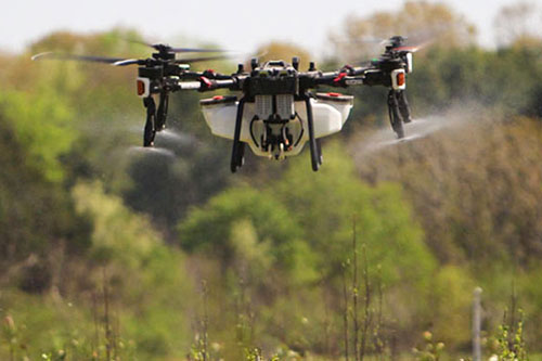
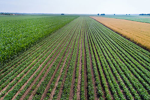
Farming is the literal foundation of life in Sylvester. Our local producers manage some of the world's most vital peanut, cotton, and pecan acreage. Yet, the Coastal Plain’s sandy-loam soils and sweltering humidity present distinct operational hurdles. Sudden summer deluges in Worth County can instantly render fields inaccessible to heavy machinery, stalling critical treatments while disease pressure and pest counts rise. Fair Lifts steps into that gap. We specialize in "all-terrain access." Our high-capacity spray drones operate when ground rigs are grounded, ensuring late-season fungicides reach the peanut canopy and cotton bolls exactly when the biological window is narrowest.
Our mission extends beyond the field to the preservation of our regional ecosystem. The Flint River watershed is a precious natural resource, and protecting its integrity requires a delicate touch. Our conservation division specializes in the targeted eradication of invasive plant species like Cogongrass and Kudzu without the soil compaction or unintended habitat damage caused by heavy ground crews. Utilizing survey-grade multispectral scanning, we identify infestations down to the centimeter, ensuring our herbicide applications are both high-impact and ecologically sound. We don't just work in Sylvester; we are investing in the longevity of Worth County’s future.
High-Fidelity Geospatial Data for the Modern Era
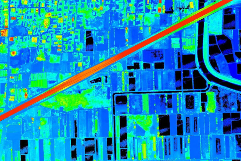
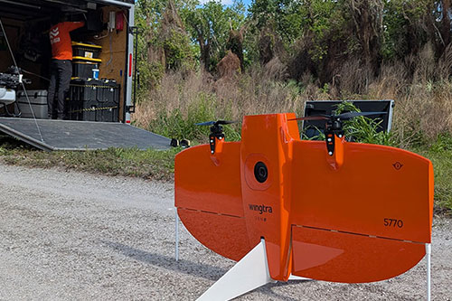
As Sylvester evolves, the requirement for hyper-accurate spatial data grows more urgent. Whether it is surveying a new industrial development along the rail lines or conducting a high-voltage utility inspection, the margin for error is non-existent. Fair Lifts Survey & Mapping delivers the exact vertical and horizontal tolerances that engineering-grade projects demand. By deploying Blue UAS-certified platforms like the WingtraOne Gen II and Riegl miniVUX LiDAR, we penetrate the dense South Georgia pine canopies to deliver millions of precise data points even in challenging terrain.
Security is paramount to our Sylvester operations. In an era of evolving digital threats, protecting regional infrastructure data is a non-negotiable priority. Our Blue UAS status confirms that we meet strict Department of Defense benchmarks for supply chain transparency and data encryption. When we map a Worth County utility substation or drainage network, your proprietary assets remain shielded from capture to final delivery. We provide more than just a survey; we provide the confidence of professional-grade, secure geospatial intelligence.
We invite you to see how Fair Lifts is optimizing the landscape and the bottom line of Sylvester, GA. Our specialized team of project leads, agronomists, and pilots is ready to help you navigate your next large-scale project. Because in Worth County, we don’t just meet expectations; we elevate them from the sky.
Regional Footprint
Local Mobilization
Our crew is stationed right here, providing 24-hour response times for Worth, Tift, Worth, and Dougherty counties.
Request Local Response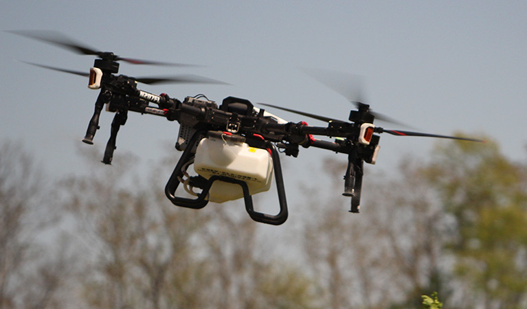
Ready to Start Your Project?
Discuss your specific goals in Sylvester with a regional expert. We provide rapid mobilization and precision scoping for every regional client.